VFR Flight Planning
Plan, navigate, and fly with confidence. Real-time weather, NOTAMs, airspace information, and advanced flight planning tools all in one app.
Available on All Your Devices
Access CaptainVFR wherever you fly - on web, mobile (iOS & Android), and desktop (macOS)
- Web Application
Full-featured flight planning directly in your browser. No installation required.
- iOS & Android
Take your flight plans with you. Available on iPhone, iPad, and Android devices.
- macOS Desktop
Native macOS application with offline capabilities and enhanced performance.
Core Features
Everything You Need for Safe VFR Flying
Comprehensive tools and real-time data for confident VFR navigation
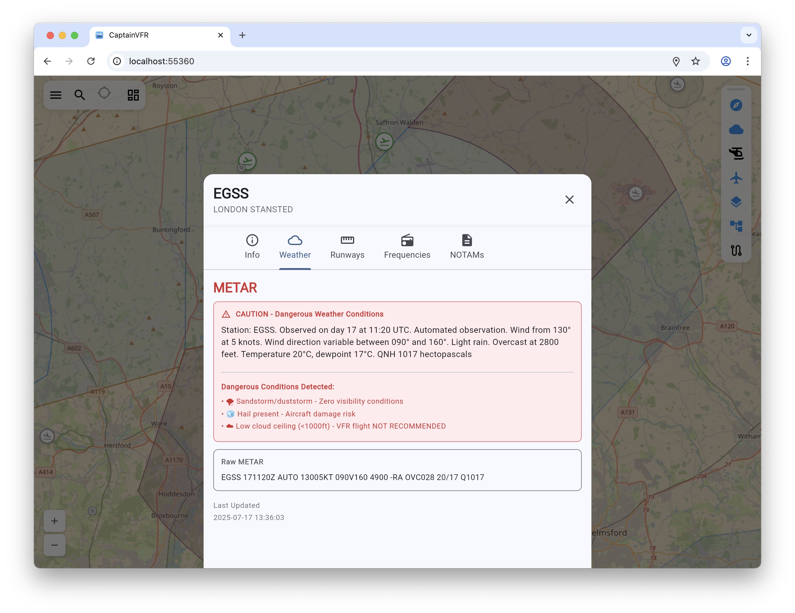
Real-Time Weather
Live METAR, TAF, and graphical weather overlays. Stay informed with current conditions and forecasts.
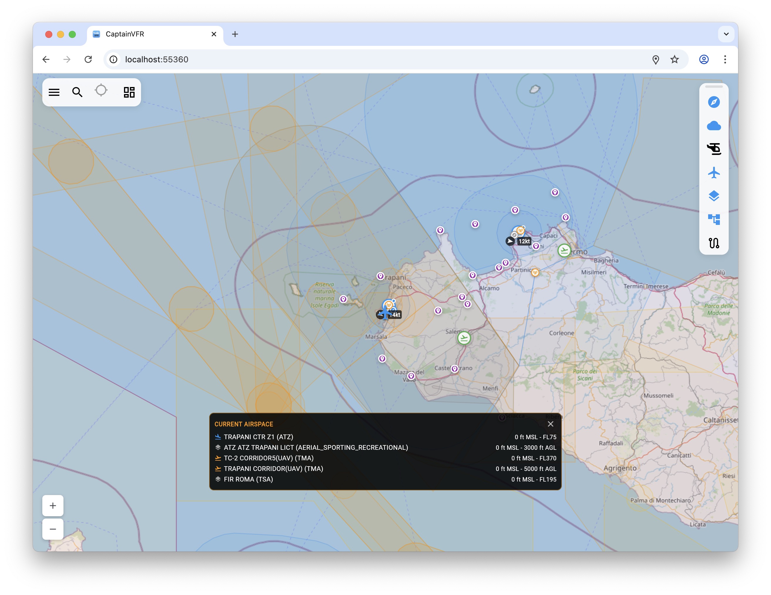
Interactive Maps
High-resolution aviation charts with airspace, airports, navaids, and custom waypoints.
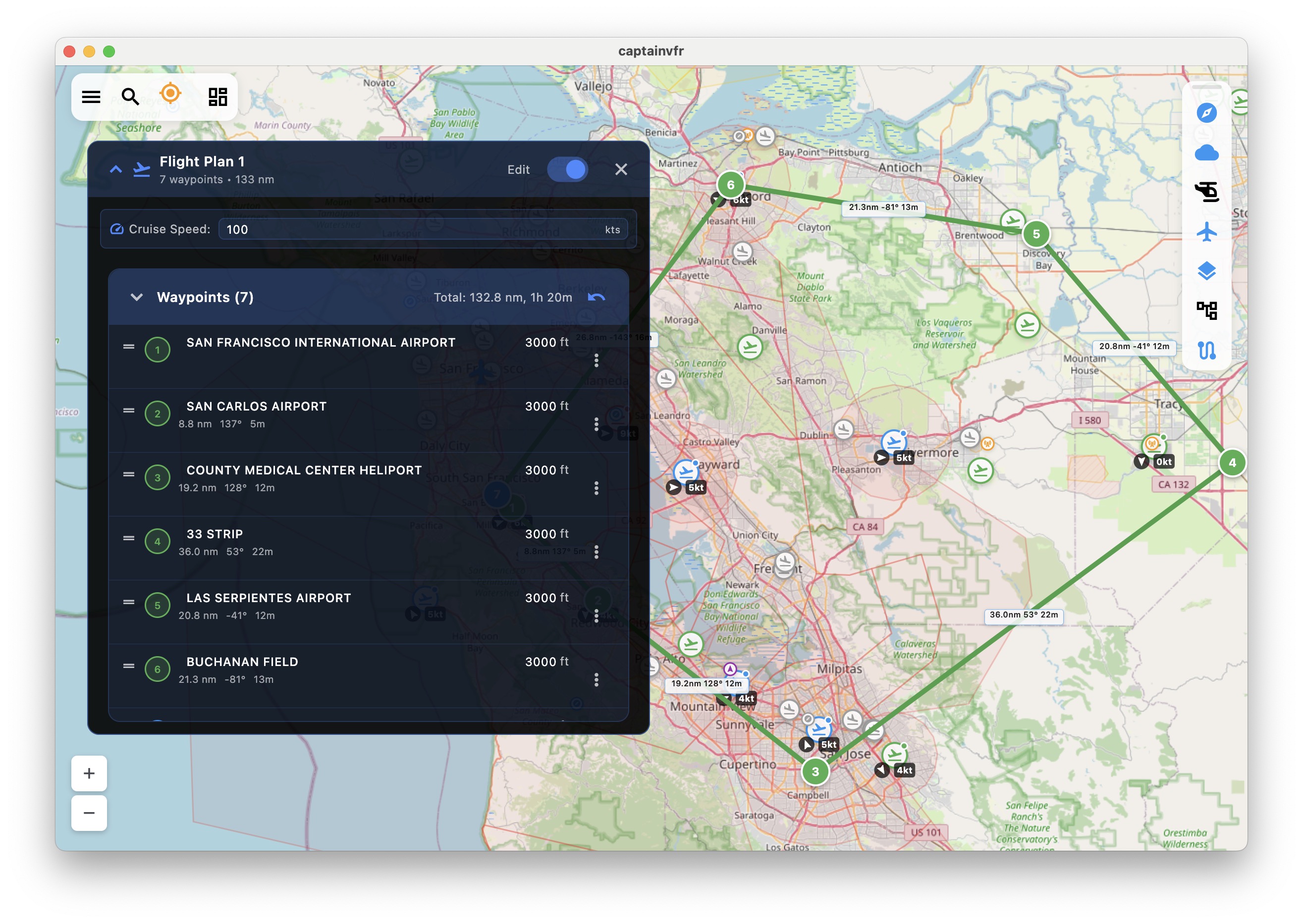
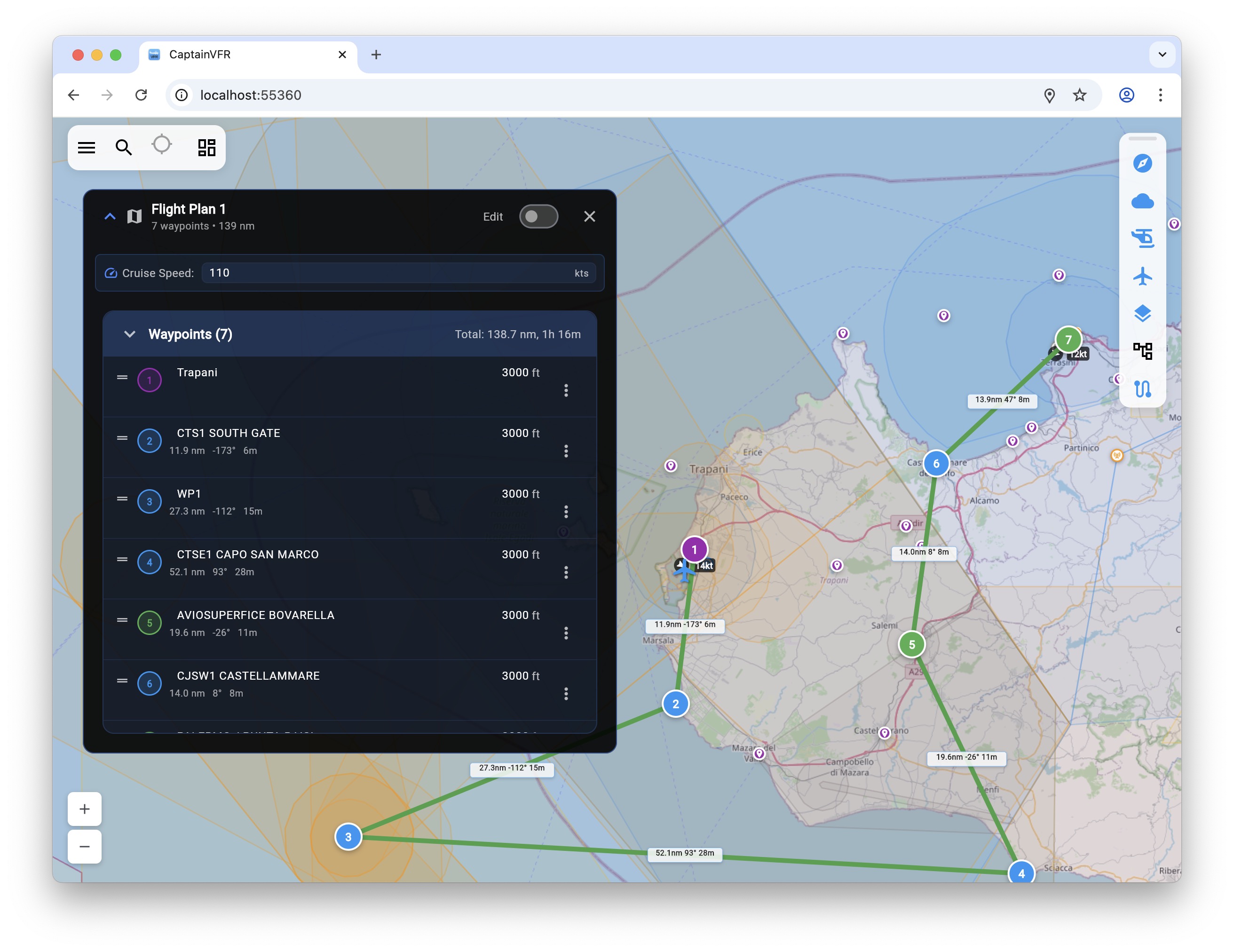
Flight Planning
Create detailed flight plans with automatic route calculation, fuel planning, and weight & balance.
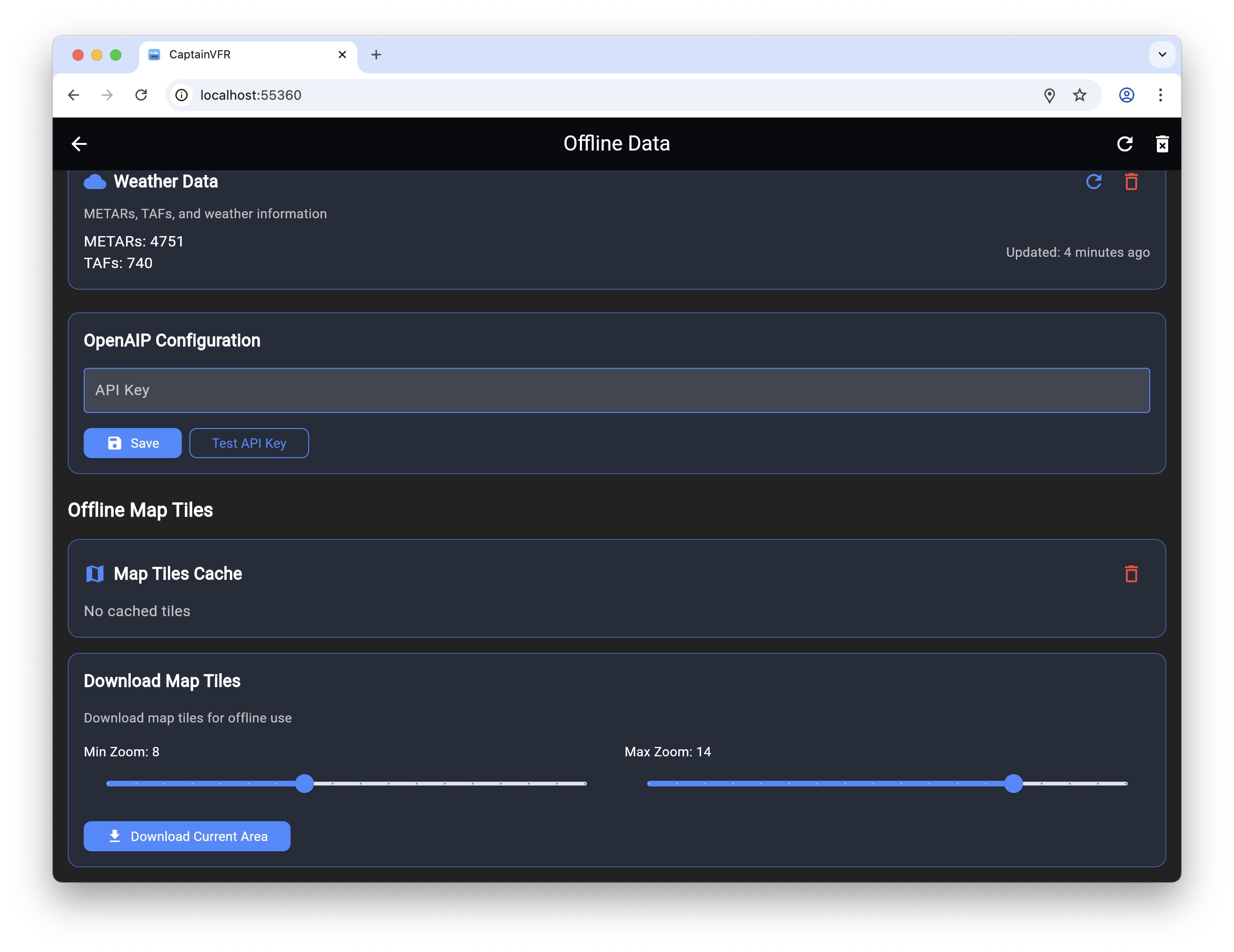
Offline Mode
Download maps and data for offline use. Plan and navigate even without internet connection.
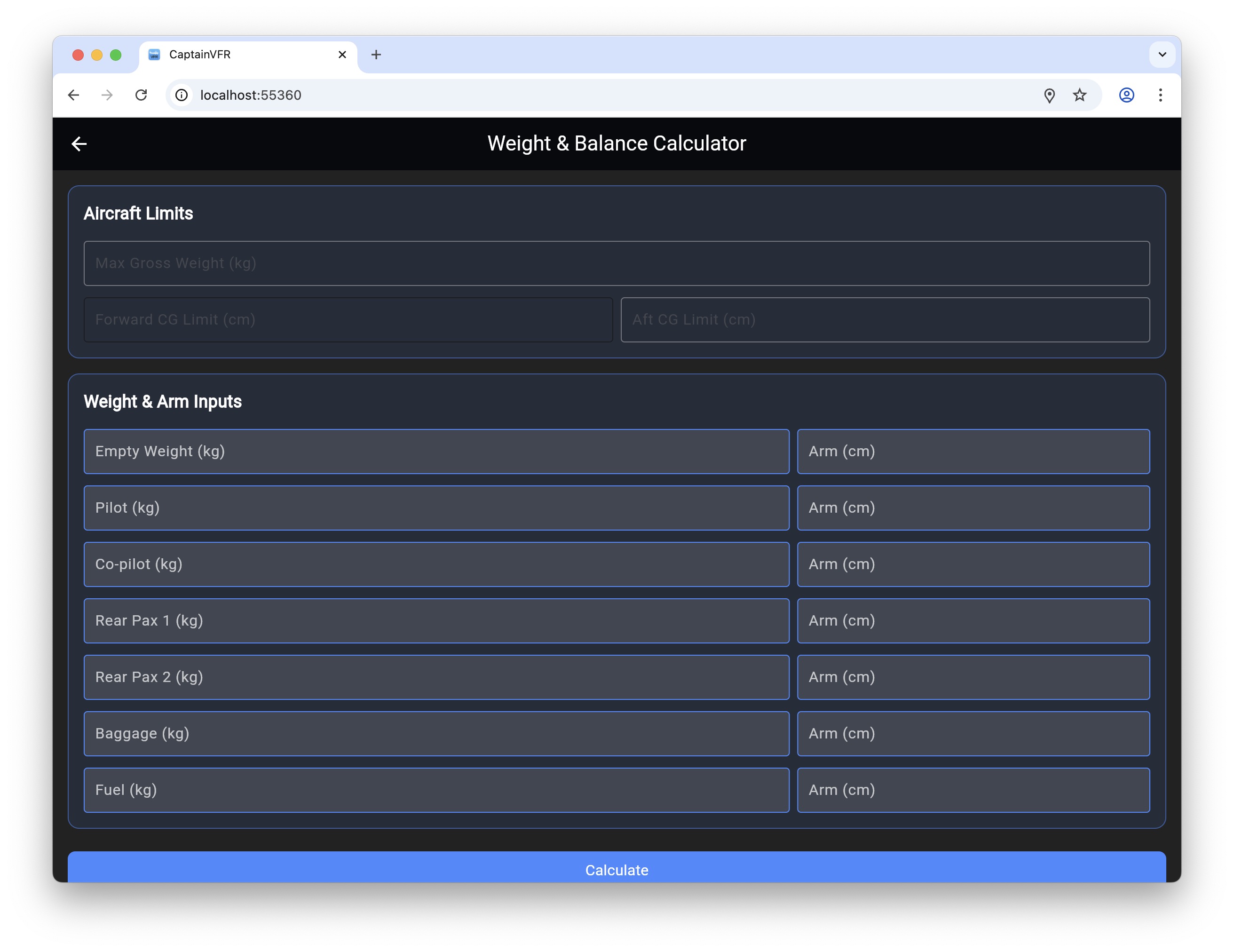
Weight & Balance
Comprehensive weight and balance calculations with visual CG representation.
Flight Tracking
Real-time GPS tracking with breadcrumb trail, flight recording, and ETA calculations for your flight plan.

Digital Pilot Logbook
Maintain your pilot logbook digitally with automatic flight imports, comprehensive entry management, and export options.
Designed for Every Phase of Flight
Comprehensive Pre-flight Tools
- Automatic route generation with airspace avoidance
- Weight & balance calculations
- Fuel planning with reserves
- Weather briefing integration
- NOTAM filtering and alerts
Trusted Data Sources
CaptainVFR uses the most reliable and up-to-date aviation data sources
- Map Data
- Map data © OpenStreetMap contributors. High-quality, community-maintained map data covering the entire world. OpenStreetMap
- Aviation Data
- Airport, navaid, and frequency data from OurAirports - comprehensive, open-source aviation database. OurAirports
- Airspace
- Airspace information from OpenAIP. Provides detailed airspace structure for navigation. OpenAIP
Download CaptainVFR
Get the app on your preferred platform and start planning your flights today